

African flow of warm air followed by heavy rainfalls: What kind of weather awaits us?
Meteorologist Marko Čubrilo published a detailed weather forecast for the next 10 days, more precisely - until May 14.
Tuesday, 04.05.2021.
11:25

African flow of warm air followed by heavy rainfalls: What kind of weather awaits us?
"On Wednesday, during most of the day, slightly to mildly cloudy, dry and a little warmer with a daily maximum of up to about 25 degrees Celsius in some places. At the end of the day, a cold front will move north of us, which will cause local destabilization of the atmosphere. In the west, north and northwest, thunder showers are possible. For now, the area where showers are expected cannot be reliably determined because only a small movement of the front to the north brings temporary cloud cover without or with very few showers," wrote Čubrilo on his Facebook.According to him, on the night towards Thursday, the wind will turn temporarily to the northwest and for a short time moderate, so that on Thursday it will be dry, but again fresher, especially in the west of the region, with daily temperatures ranging from 13 to 20 degrees Celsius.
On Friday, it will be warmer again, with a south wind and a maximum daily temperatures of up to about 28 degrees Celsius in the shade.
"At the end of the day, with the approach of a new front in the west, southwest and northwest of the region, destabilization of the atmosphere, with thunder showers is expected. For now, it seems that the potential for some heavy showers and strong thunderstorms is much higher far in the west, southwest, and northwest of Croatia and perhaps in the northwest part of Bosnia-Herzegovina, north and west parts of Serbia. All other areas, including the larger part of the eastern half of the region could even stay dry, apart from the increased northwest wind and some minor refreshment, without showers", Cubrilo explained.
On Saturday, he says, it will be mostly dry and fresh again, with maximum daily temperatures of 12 to 18 degrees Celsius.
"From May 9 onwards, a stronger anticyclone is expected over this part of Europe, while western and southwestern Europe should expect humid and unstable air, with cyclogenesis expected over the western Mediterranean," Čubrilo claims.
In such conditions, a larger amount of dry and warm air could reach this part of the peninsula from North Africa, and after these cold weeks, that period could bring real summer heat and maximum daily temperatures of 30+ degrees Celsius.
"Around March 14, an anticyclone disturbance with thunder showers and refreshment is expected, which would be an introduction to a fresher and more unstable part of the month," says Čubrilo.
He also added forecasts for the summer: "As for the weather forecast for summer 2021, my long-term forecast will be published in early June when data for this month is available to forecast models. For now, it seems that summer could be a little warmer and a little drier than average, especially for the Adriatic and southern parts of the region, but currently the ECMWF forecast is with the highest temperatures, while everyone else's seems to be fresher".
According to him, the week ahead brings typical weather for this month, with warm days, along with passing showers and mild refreshments early next week.
0 Komentari
Možda vas zanima
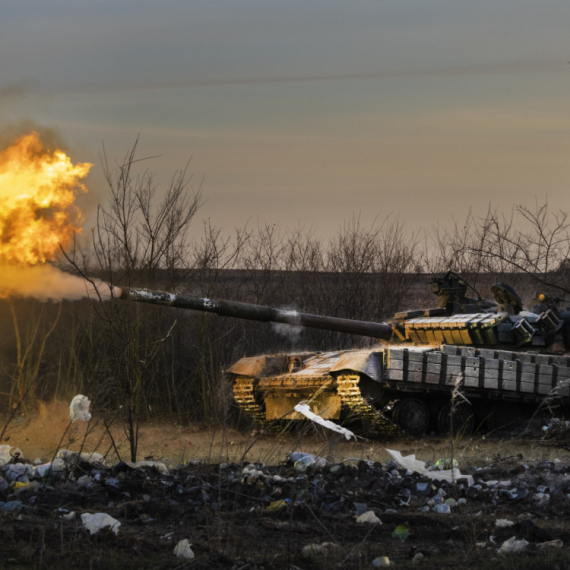
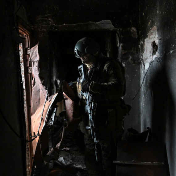
Rat – dan 791: Novi napadi; Bajden potpisao: Stiže pomoć; Vojska u "paklu"
Rat u Ukrajini – 791. dan.
23:30
24.4.2024.
1 d
Zakazan sastanak: Sprema se kraj rata?
Savetnici za nacionalnu bezbednost i visoki zvaničnici iz celog sveta spremaju se za sastanak koji će ovog vikenda biti održan u katarskoj prestonici Dohi.
15:07
25.4.2024.
23 h

Zvezda u finalu Kupa – dupla pobeda u derbijima; Milojevića naljutilo pitanje; Duljajev status upitan
Fudbaleri Crvene zvezde plasirali su se u finale Kupa Srbije, posle pobede nad Partizanom rezultatom 2:0.
22:37
24.4.2024.
1 d
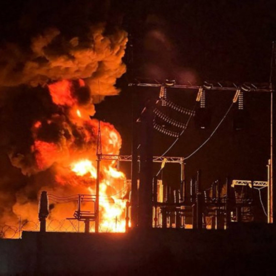
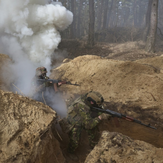
Rat – dan 792: Novi udarac za Zelenskog; Žestoke borbe, na hiljade mrtvih; Stigla osveta
Rat u Ukrajini – 792. dan. Udari ukrajinskih dronova na ruska skladišta goriva i čeličanu.
23:38
25.4.2024.
15 h

Bojkot kafića, pekara i restorana: "Preterali ste"
Poslanici u Turskoj juče su u skupštini na dnevnom redu imali i raspravu o tome kako da se zemlja izbori s velikim rastom cena.
16:49
24.4.2024.
1 d


Komentari 0