

Meteorologist announced: A change of weather is coming
The weather forecast for the coming days brings cold weather, while meteorologist Djordje Djuric announced what New Year's Eve will bring.
Wednesday, 22.12.2021.
20:55
Meteorologist announced: A change of weather is coming
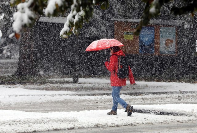
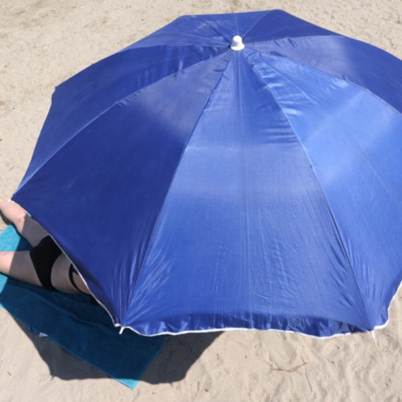
According to his forecast, great temperature ups and downs await us."On the first day of winter season in December, the temperatures this morning were in accordance with that. The minimum morning temperature in most parts of Serbia ranged from -10 to -2, on Kopaonik it was -16 degrees, and in Sjenica - 20. Thanks to the influence of the 'heat island', which occurs in calm and stable weather conditions (anticyclonic weather), the center of Belgrade as a large urban and industrial environment was the warmest this morning with -2. Maximum temperatures will turn 'positive' today and will range from 1 to 4. In favor of high air pressure, low temperatures and windless weather, there was a very pronounced air pollution throughout Serbia", Djurić writes.
The thaw is coming
Its weather forecast predicts another icy night between Wednesday and Thursday, with temperatures from -12 to -4, in Pester to -15, and on Thursday, during the day, warming will begin from the west due to the advection of warmer air mass."If it is a consolation and how much the climate is milder in our area, the data show that today in the north of Sweden -35, and in Moscow -21. Although the first association with Moscow is polar temperature, it is not so, because thanks to the proximity of the Atlantic (although it is 2000 km away), Moscow has very mild winters compared to Siberia and the extreme northeast of Russia, where average temperatures are up to -60 in winter, while in Moscow the average maximum temperature in December is -2, while in January -4.
In recent years, Moscow and the northern areas have seen a much higher increase in average temperatures compared to the area at lower latitudes, so winters are already a few degrees warmer in this period on average than 20-30 years ago", says Djurić and adds that the situation is similar in Serbia and many other parts of the world, thanks to the constant rise in global temperature since the late 1970s.
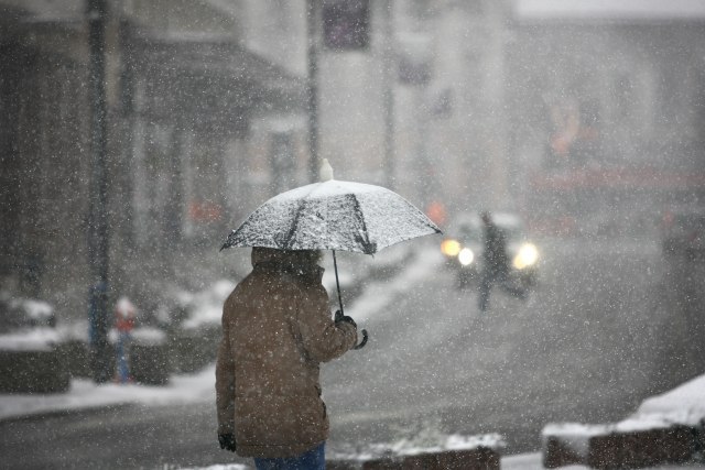
According to meteorologists, the weather forecast from Friday in all parts of Serbia will bring us significantly warmer weather - it will be moderate to mostly cloudy. "Dry on Friday, rain in northern Serbia on Saturday, rain in other areas on Sunday, and rainy but very warm in all areas at the beginning of next week. Although thunder showers are very rare in the winter part of the year, due to the expected synoptic situation, clouds and precipitation systems will be affected by the movement of valleys over our areas. Maximum temperature as early as Friday and up to 17, in Belgrade up to 15 degrees, only in Negoti Krajina and in the south colder weather is expected'', he says.
"After today's very polluted air, from Friday to the end of this year, thanks to the synoptic situation, we will have better air quality. As rain and temperatures of over 10 degrees are expected in the mountains over 1000 meters, the snow would melt abruptly at these heights. When it comes to Kopaonik, the current height of the snow cover is 93 cm, but despite the sudden melting from Friday to the middle of next week, there will be more than enough snow, and new amounts of snow are expected from December 29. However, until then strong south wind and warmer weather will not help the skiers, but there would certainly be about half a meter of snow left until the new snow, thanks to very abundant amounts of snow during most of December", says Djurić.
Temperature drop for the New Year
"In the middle of next week, a cyclone would form in the Adriatic Sea, which would continue to bring rain and very warm air mass from the south and the Mediterranean to our area, and a strong southeast wind would blow in the Košava area. However, on Wednesday, December 29, as it is expected to move across our area further to the east, Serbia would find itself in the cold sector of the cyclone, so there would be avection of significantly colder air masses and temperatures would drop by ten degrees, and rain in the lower regions would turn into sleet and snow, but according to current forecasts, on New Year's Eve, temperatures in the cities would be below 0°C, in the mountains in a 'stronger minus'. For now, it would be dry," concludes Djurić.
0 Komentari
Možda vas zanima

Rat – dan 791: Novi napadi; Bajden potpisao: Stiže pomoć; Vojska u "paklu"
Rat u Ukrajini – 791. dan.
23:30
24.4.2024.
1 d
Zakazan sastanak: Sprema se kraj rata?
Savetnici za nacionalnu bezbednost i visoki zvaničnici iz celog sveta spremaju se za sastanak koji će ovog vikenda biti održan u katarskoj prestonici Dohi.
15:07
25.4.2024.
1 d

Zvezda u finalu Kupa – dupla pobeda u derbijima; Milojevića naljutilo pitanje; Duljajev status upitan
Fudbaleri Crvene zvezde plasirali su se u finale Kupa Srbije, posle pobede nad Partizanom rezultatom 2:0.
22:37
24.4.2024.
1 d
Rat – dan 792: Novi udarac za Zelenskog; Žestoke borbe, na hiljade mrtvih; Stigla osveta
Rat u Ukrajini – 792. dan. Udari ukrajinskih dronova na ruska skladišta goriva i čeličanu.
23:38
25.4.2024.
19 h
Stiže novi "pakao"; Spremite se
Kao u prvih 15 dana aprila, ovaj mesec će se završiti natprosečnim temperaturama. Prema najavi RHMZ u nedelju i do prve polovine naredne sedmice temperature će dostići letnje vrednosti.
7:21
26.4.2024.
11 h


Komentari 0