23.12.2025.
8:50
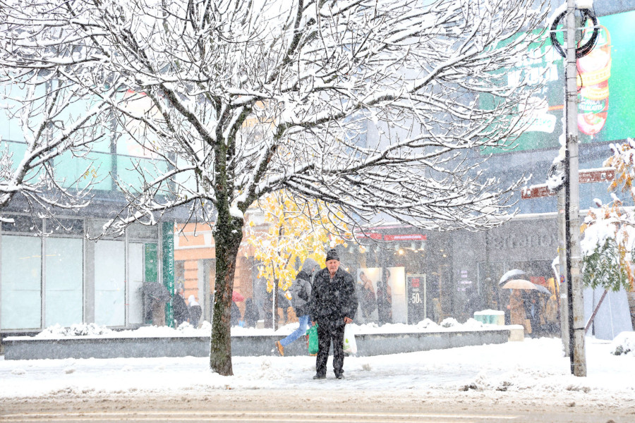
A 'Russian winter' is sweeping into Serbia; New Year's Eve, Christmas - under the influence of that cold surge
Meteorologist Ivan Ristić says that on December 25 the dominance of the African cyclone—a blocking system over our region that brought fog and pollution—will come to an end, and that cold air from Russia will arrive in Serbia accompanied by the košava wind.

Meteorologist Ivan Ristić says that on December 25 the dominance of the African cyclone—a blocking system over our region that brought fog and pollution—will come to an end, and that cold air from Russia will arrive in Serbia accompanied by the košava wind, the so-called “Russian winter,” which will bring snow.
Ristić expects the most snow in the east and southeast, with the snow line around Zrenjanin or Novi Sad.
“The first snow shown by the models begins on Thursday this week as a phenomenon accompanied by a cold košava wind. It will be cold, with light snow flurries during the day, and after that, as the New Year approaches, the chances of snowfall will increase. At the moment, I expect that in some places there could be more than 20 cm of snow, while Belgrade can expect around 5 cm. Snow is expected on Zlatibor, Kopaonik, and in Belgrade, and there is also a high chance of snow in Leskovac in the afternoon. In the north and other areas without snow, rain will fall,” Ristić says.
He notes that the alignment of weather models has confirmed his long-term forecast, and that a textbook example of an ATR block over the Atlantic can currently be seen for the New Year period.
Around the New Year, we can expect a true winter idyll
“Everything is going according to the forecast. The green color on the chart represents small cyclones that will pass to the south, possibly even over us, and will bring snow. Around the New Year, we can expect a real winter idyll. Cold Arctic air will cover Europe, and toward the end of the year air pressure, and especially the geopotential at 500 mb, will decrease over our region, which indicates a strong chance of intermittent snowfall and the formation of a snow cover. Temperatures will be below freezing for most of the day,” Ristić says.

A cold January with snow
He notes that he has not seen maps like these in a long time, as all models are forecasting that January will be below average, with a high likelihood that this year we will experience a true winter with many cold days. Current projections show that maximum temperatures in January will range between −2°C and 3°C, while minimum temperatures will be between −7°C and −2°C.
From December 29, even colder air will arrive, which will be felt especially in the mountains. The largest amounts of snow are expected from January 2 until Orthodox Christmas. Ristić says that the first ten days of January will be very cold and snowy.
“We will have frost every day. Snow will fall intermittently. In January, the chances of snow are even higher. There will be snow in the mountains, but lowland areas will also be covered with snow. Once a snow cover forms, temperatures will be much lower—we expect ice days. We need to wait for the snow cover to form, but as soon as we see it, we can expect stronger frost and ice days. From December 29, even colder air will arrive and real winter will begin,” Ristić says.
He adds that there is currently no “winter killer”—an Atlantic anticyclone that usually pushes warm air from Africa toward our region.
“A white Christmas is moving into Europe. Winter will be within normal limits or slightly below average, like it used to be. This will be a real winter,” the meteorologist concludes.
0 Komentari
Možda vas zanima

Siner je kralj Vimbldona!; Zverev se oglasio: "Ne volim te"; Janik poručio Saši: "Baš si blizu..."
Janik Siner je Grend slem šampion.
21:53
12.7.2026.
10 h

Belingem "preveslao" Norvežane – Engleska kroz produžetke do polufinala!
"Vikinzi" će žaliti za prečkom, poništenim golom i nekoliko sudijskih odluka
2:40
12.7.2026.
1 d

"Pauk" skinuo pauka! Na švajcarskom satu piše da nije kraj za Mesija i Argentinu VIDEO
Bude se duhovi prošlosti pred duel Engleske i Argentine, prvog nakon čuvenog iz 1986. godine
6:18
12.7.2026.
1 d

Gol Belingema je neregularan? Hitno se oglasila FIFA! VIDEO
Norvežani su veoma nezadovoljni suđenjem u meču protiv Engleske
3:25
12.7.2026.
1 d

Rat – dan 1.598: Porastao broj poginulih u Sumi; Mađarska odbila Putina; Pogođeni ruski brodovi FOTO/VIDEO
Rat u Ukrajini ušao je u 1.598. dan, a broj poginulih u ruskom vazdušnom udaru na Sumi porastao je na pet, a povređenih na 31.
23:39
11.7.2026.
1 d


Komentari 0
Pogledaj komentare Pošalji komentar