






04.09.2026.
12:18
This could change the way we see the world: UN to decide on a New Map of the Planet
The United Nations General Assembly will vote on a historic resolution recommending the formal abandonment of the traditional Mercator world map in favor of a new version that more accurately depicts the actual size of Africa and countries in the Global South.



Although UN resolutions are not legally binding, the adoption of this proposal could trigger sweeping changes in education systems around the world, as well as in everyday technology, given the widespread use of the existing map in applications and administrative systems.
The Mercator projection was introduced by Flemish cartographer Gerardus Mercator in 1569 to assist sailors with navigation. Nearly five centuries later, it remains a global standard.
However, because of the way the spherical shape of the Earth is represented on a flat surface, areas near the equator appear significantly smaller than they actually are, while regions at higher latitudes are visually enlarged to a dramatic extent. The most striking example is that Africa appears to be roughly the same size as Greenland on the map, even though the African continent is actually 14 times larger than the Danish territory.
The initiative was officially launched by Togo and has been supported by 54 other member states of the African Union.
Togo’s Foreign Minister Robert Dussey says the time has come for change.
“This discussion is not political, but scientific. There is scientific evidence, and we must all accept reality,” Dussey said.
Historians and geographers have for years warned that the Mercator map is rooted in Western stereotypes, while activists have even coined the term “cartographic colonialism.”
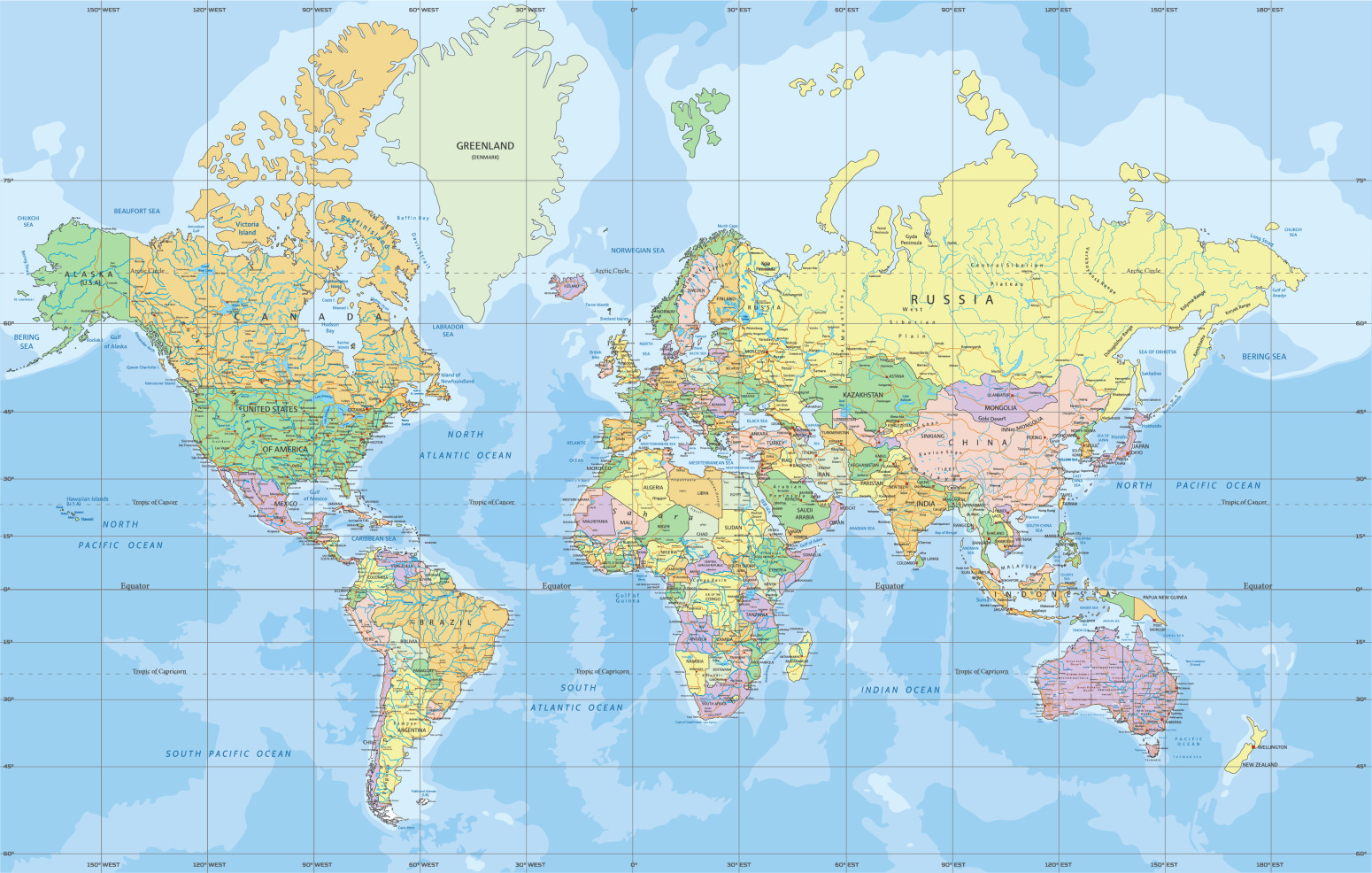
Critics argue that the map has subtly shaped international power dynamics by visually enlarging countries in the Northern Hemisphere while diminishing the physical size of Africa. They believe this has contributed to systemic biases in international trade and development priorities for decades.
The #CorrectTheMap campaign, which has collected more than 11,000 signatures, promotes the use of the more modern and accurate Equal Earth projection, developed in 2018.
“You could fit the United States, China, India, Japan, Mexico and much of Europe into Africa and still have land to spare,” the petition states.
If the vote is successful, Togo plans to hold a major event in its capital, Lomé, early next year. Representatives of UNESCO, the African Union and technology giants such as Google are expected to discuss the implementation and adoption of the new map.
0 Komentari
Možda vas zanima

Partizan srušio Zvezdu; Pajola heroj! Karlik: "Nemam reči"; Italijan objasnio pobedu crno-belih
Košarkaši Partizana pobedili su Crvenu zvezdu rezultatom 85:82 u 7. kolu Evrolige.
23:57
22.10.2026.
18 h

Neverovatni prizori u 150 mesta u Srbiji: Okupljanja i podrška listi "Ujedinjena Srbija"; Orio se "Ruzmarin"
Građani Srbije u 150 gradova i sela organizovali su skupove poslednjeg dana izborne kampanje kako bi iskazali podršku listi "Aleksandar Vučić – Ujedinjena Srbija".
22:19
22.10.2026.
20 h

Zvezda umalo opet sve prosula; Rijera nije zabrinut; Elšnik neće da "baca saigrače pod autobus"
Fudbaleri Crvene zvezde remizirali su sa Kopenhagenom 2:2 na stadionu "Rajko Mitić" u drugom kolu Lige konferencije.
22:14
22.10.2026.
20 h

Rat – dan 1.671: Rusi ponovo napali Kijev; Putin: "Možemo da postignemo dogovor" FOTO/VIDEO
Rat u Ukrajini – 1.671. dan. Rusi su u toku noći pokrenuli novi udar na Kijev. Ruski predsednik Vladimir Putin izrazio je danas uverenje da Rusija i Ukrajina mogu da postignu dogovor.
23:58
22.10.2026.
18 h

Rat – dan 1.670: Ukrajina spremna za sporazum; Važan razgovor Putina i Trampovog izaslanika FOTO/VIDEO
Rat u Ukrajini – 1.670. dan. Ukrajina je spremna da prihvati mirovni sporazum koji će zamrznuti rat na trenutnoj liniji fronta, izjavio je danas ukrajinski predsednik Volodimir Zelenski u intervjuu za Foks njuz.
23:55
21.10.2026.
1 d












Komentari 0
Pogledaj komentare Pošalji komentar