

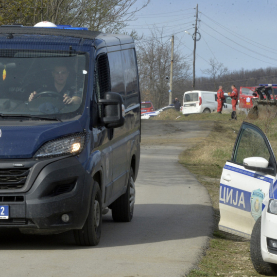
Serbia has been warned, the situation is unfavorable. Real chaos awaits us
Today until the middle of the day, during the afternoon and early evening, there's a danger of strong thunderstorms and local disasters in many parts of Serbia.
Tuesday, 16.05.2023.
15:45

Serbia has been warned, the situation is unfavorable. Real chaos awaits us
According to the warning of meteorologist Marko Čubrilo, showers and storms are expected especially over the western parts of central and southern Serbia, Srem, Mačva, Šumadija, parts of western and southern Bačka, in the south of Srem, Mačva and Šumadija and the east of the region of central and southern Banat, Stig and Braničevo."Tuesday and Wednesday will be very unstable with thunderstorms and local storms, and Thursday will bring a temporary cooling and occasional rain. The weekend is expected to be more stable and warmer, and at the beginning of next week there will be more instability again with temperatures around or slightly below average", Čubrilo said.
As he explained, on Tuesday the weather over the region will be under the influence of a strong cyclone over central Italy.
That cyclone will move moist and unstable air towards us. As a result, during the day, a series of precipitation zones will move across the region, between which it will be dry with sunny intervals. As warmer air will arrive in the southern current, the energy in the atmosphere will be significantly higher than in the past days.
In the Košava area, there will be another, transient, strengthening of the southeast wind, which in the middle of the day can be very strong in some places.
The season of storms
"There is no way to accurately predict in advance the place of activation of the atmosphere or the path of these systems, so the warning practically applies to the entire region. For the first time this storm season, the instability indices will be high enough for the possibility of developing supercell storms, but will they form and where it depends on details that cannot be predicted in advance. On Tuesday, the maximum temperatures will be from +17 in the west to around +25 in the east of the region," he said.According to his calculations, it will be unstable again on Wednesday, especially in the afternoon and evening, but the southerly flow will stop and the northwesterly wind will start, and it will cool down. It is not possible to predict how the atmosphere will behave on Wednesday, but there will again be strong showers and local disasters.
On Thursday, it will be cooler over the entire region with occasional rain and showers, but there should be no more danger of severe weather. A moderate, northwesterly wind will blow, while daily maximum temperatures would range from +11 to +17 degrees Celsius.
Weekend more stable
It is expected to be more stable and warmer on Friday and over the weekend, but there will be local downpours in some places, mainly in the hilly and mountainous part of the region. The wind is generally weak, and the daily maximum is from +18 to +25 degrees Celsius."Unstable again early next week, with more frequent showers and highs around or slightly below average. Tuesday and Wednesday, tomorrow, there is a high probability of strong thunderstorms, localized damage, hail, gale-force winds and strong radiation. In areas where strong instabilities are possible in a short time, 15 minutes to half an hour, about 35 millimeters of precipitation can fall," he concluded.
1 Komentari
Možda vas zanima

Otkriveno džinovsko nalazište nafte – 10 milijardi barela: Uskoro poziv u OPEK?
Zbog ovog otkrića još jedna država mogla bi da pristupi Opeku.
11:06
24.4.2024.
1 d
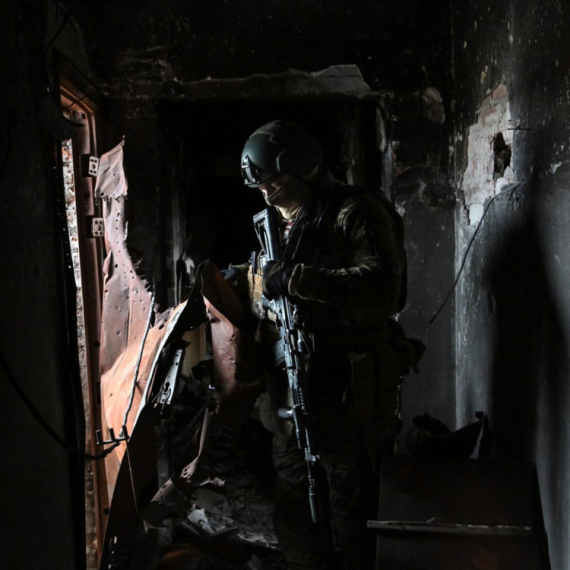
Rat – dan 791: Novi napadi; Bajden potpisao: Stiže pomoć; Vojska u "paklu"
Rat u Ukrajini – 791. dan.
23:30
24.4.2024.
1 d

Zvezda u finalu Kupa – dupla pobeda u derbijima; Milojevića naljutilo pitanje; Duljajev status upitan
Fudbaleri Crvene zvezde plasirali su se u finale Kupa Srbije, posle pobede nad Partizanom rezultatom 2:0.
22:37
24.4.2024.
1 d
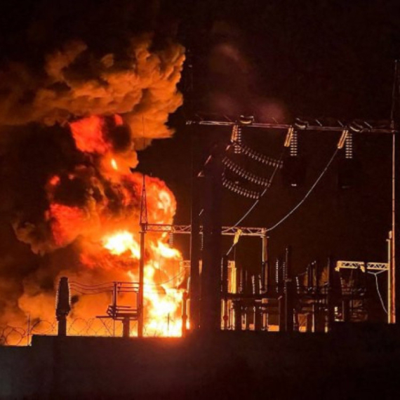
Rat – dan 792: Novi udarac za Zelenskog; Žestoke borbe, na hiljade mrtvih; Stigla osveta
Rat u Ukrajini – 792. dan. Udari ukrajinskih dronova na ruska skladišta goriva i čeličanu.
23:38
25.4.2024.
56 min

Bojkot kafića, pekara i restorana: "Preterali ste"
Poslanici u Turskoj juče su u skupštini na dnevnom redu imali i raspravu o tome kako da se zemlja izbori s velikim rastom cena.
16:49
24.4.2024.
1 d


Komentari 1
Pogledaj komentare